50 de mest populära böckerna i Sverige●Atlaser och kartböcker
Kolla in den senaste listan över böckerna som folk i Sverige gillar mest just nu. Listan är sorterad efter popularitet och listans genre är Uppslagsböcker > Atlaser och kartböcker.
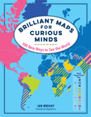
1. Brilliant Maps for Curious Minds - Ian Wright. 100 New Ways to See the World

A singular atlas of 100 infographic maps from thought-provoking to flat-out fun. And don’t miss the next book in the series, North American Maps for Curious Minds ! Publisher’s note: Brilliant Maps for Curious Minds was published in the UK under the title Brilliant Maps. Which countries don’t have rivers? Which ones have North Korean embassies? Who drives on the “wrong” side of the road? How many national economies are bigger than California’s? And where can you still find lions in t...
Releasedatum: 2019-11-05 125,00 kr
2. La France. Atlas géographique et politique - Stéphanie Beucher, Florence Smits & Collectif

Un atlas de référence pour préparer les concours. La France fait face à de nombreux défis. Saura-t-elle s’adapter et se réinventer ? Cet atlas, riche de plus de 150 cartes et documents, dresse le portrait du territoire métropolitain et ultramarin à toutes les échelles et dans toutes ses dimensions : • Les dynamiques de peuplement des territoires et les disparités d’installation des 67 millions de Français. • Les environnements contraints entre valorisation et protection. ...
Releasedatum: 2020-06-24 179,00 kr
3. Atlas de l'Empire romain. Construction et apogée (300 av. J.-C. – 200 apr. J.-C.) - Christophe Badel

"Par quels moyens les Romains ont-ils pu se rendre maîtres de presque tout le monde habité ?" (Polybe) Plus de 100 cartes, plans et schémas pour comprendre les origines et les implications de l’impérialisme romain. • Par quels moyens politiques, économiques et culturels les Romains sont-ils parvenus à étendre leur territoire sur les pourtours de la Méditerranée et au-delà ? • Comment les Romains ont-ils construit et administré cet empire, d’Alexandrie jusqu’à l’...
Releasedatum: 2020-01-15 129,00 kr
4. The Family Tree Historical Atlas of Germany - James M. Beidler

Delve into your German heritage! This carefully curated collection of beautiful historical maps of Germany will help you sort out the mess that is German history. With these 100-plus full-color maps, you can view German border changes throughout the centuries, allowing you to find your German hometown and records of your ancestors. Inside, you'll find: · Beautiful maps of German states from medieval times to present, each selected specifically for...
Releasedatum: 2019-05-28 179,00 kr
5. The Family Tree Historical Maps Book - Europe - Allison Dolan & Family Tree Editors. A Country-by-Country Atlas of European History, 1700s-1900s

Journey to the Old Country From Ireland to Italy, Portugal to Poland, Germany to Greece, and everywhere in between, explore your ancestors' European homelands through more than 200 gorgeous reproductions of 18th-century maps, 19th-century and early 20th-century maps. These full-color period maps--covering the peak years of European immigration to America--will help you understand changing boundaries in ancestral countries, and inform your search for genealogical records. Inside you'll find: ...
Releasedatum: 2015-03-16 179,00 kr
6. Grand Atlas de l'Antiquité romaine - Christophe Badel & Hervé Inglebert

Depuis sa création jusqu'à la chute de Rome, cet atlas retrace, au fil des cartes, l'histoire de l'empire romain et montre : • comment les Romains ont contrôlé un territoire presque aussi vaste que le monde connu d'eux ; • comment ils ont réussi à gérer cet empire durant plusieurs siècles, par des politiques administratives et territoriales originales ; • comment la chute de Rome face aux barbares, longtemps perçue comme une rupture et la conséquence d'une période de décadence,...
Releasedatum: 2019-01-16 169,00 kr
7. Oman Visitors Guide - Explorer Publishing

Our latest Oman Visitors' Guide is small enough to fit in your bag but is big on information about this mesmerising country. Written and researched by local residents, this brilliant guide is bursting with up-to-date detail and stunning images. The mini marvel covers every corner of Oman, from exploring souks of Muscat, turtle spotting on a beach to fine dining in some of Oman's top restaurants. This is an indispensable guide to an inspirational country. Includes offline map and Google map...
Releasedatum: 2016-07-25 105,00 kr
8. Manhattan NYC Map and Guide plus subway - Alberto Michieli. With Downtown Brooklyn and Williamsburg

Manhattan, Brooklyn Downtown, Williamsburg, Long Island City, subway full system It is laminated and durable, waterproof if you have iPad waterproofed. New York City Map Guide will make you like a resident. detailed streets of Manhattan, downtown Brooklyn, Williamsburg, the map also includes a complete 5 boroughs Subway Map, Landmarks Museums, points of interest, and getting to and from the city s airports. Ask me for a promo code, for reviews, bad or cute Who we are: A project started in ...
Releasedatum: 2019-02-19 25,00 kr
9. Sea Monsters - Joseph Nigg. The Lore and Legacy of Olaus Magnus’s Marine Map

Olaus Magnus’s 1539 Carta Marina can be considered the major source of Renaissance sea monster iconography and lore. The map and its voluminous commentary, History of the Northern Peoples, established Olaus as the innovative historian of the sea serpent, the giant squid and sea monsters in general. Sea Monsters is structured around Olaus’s map – which is reproduced as a beautiful fold-out on the back of this book jacket – and the charts that two pre-eminent sixteenth-century cartographer...
Releasedatum: 2013-09-01 139,00 kr
©All data provided by Apple Inc.
©Design by nowtrendy.net.